Translate this page!

Thursday, September 8, 2011

Lake James State Park: Nebo, NC- 9/5/2011

Our campsite.
Location:Lake James State Park
Date: 8/5/2011
How far we went: Too lazy and tired to do trails
How long it took us: n/a
Elevation reached: n/a
Weather: Rainy


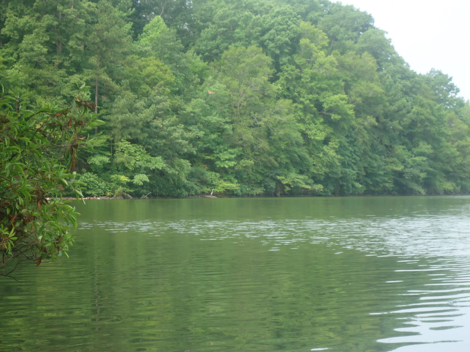
What can I say about Lake James State Park? It was decent. It's technically "car-camping" but you have to hike your gear and crap in about 3-400 yards. The bathrooms are okay, about the par for NC State Parks. The lake was a murky green colour and the swimming area was closed. Probably for our protection. The rangers came by about 6pm in the middle of our relaxation and told us there would be 6-8 inches of rain and that all but us and someone else had left in fear. So we hunkered down ready for some man vs. wild type of action. But actually, nothing happened at all. We woke up to a couple of raindrops... Bummer. If you go here make sure you've made a reservation and scoped out the sites to see which one will suit you best. If you don't have a boat, a jet-ski or a fishing pole. There really isn't much here... A few trails and overlooks, but nothing compared to the other natural attractions on this side of the state.

If you take nothing else from this post, when you sign in, they will ask you if you want to buy firewood. You have to because you're not allowed to pick up anything and burn it... Anyways, after you pay the $5 they then tell you that the wood is located by camp site #3 in a giant pile and you can just take it at will. I am against paying for anything that is "public," especially after I've already paid for a site, a fishing permit, etc... So just tell them no and go steal the wood.

Dock across from site #17


Me prepping for dinner


Vegetarian camp cooking. Love it.
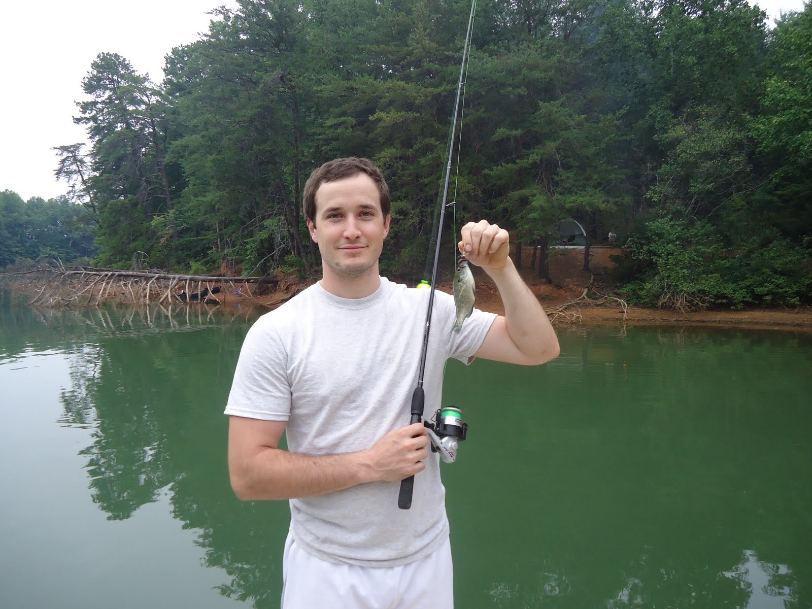
Joe catching a fish

Mt. Mitchell State Park (Mt. Mitchell & Commissary Trails) - 9/4/2011


Location: Mount Mitchell State Park
Date: 9/4/2011
How far we went: 3.56mi
How long it took us: 2:37:14
Elevation reached:  6544ft
Weather: lil chilly, windy, rainy, wet


Well... Another rainy vacation day. Remnants from a hurricane/tropical storm or whatever were definitely there to greet us when we arrived. If you didn't know, the peak of this mountain is the highest point east of the Mississippi. Decided not to be a tourist and take the picture with the sign saying so. We went down the Mt. Mitchell trail which was pretty easy, then hooked a right along a bridal trail filled with (horse) shit and headed up the Commissary trail. Not a bad little place. Shout-out to the staff there, they were really nice. Didn't like it as much as Grandfather Mountain, then again, we didn't have all that much time. be sure to check it out if you're in Western, NC. Here are some pictures, but view the whole set here.


here.

Friday, September 2, 2011

Carolina Beach State Park- 8/3/2011

Following the path on the one side of the Sugarloaf Trail on the Carolina Beach State Park map says there is a point of interest. However, it was blocked by a few barriers/fences. They may or may not be there when you go. On the track above, you can see where we hit that point of interest where the blue trail meets the water. It was very nice. 
Location: Carolina Beach State Park
Date: 8/3/2011
How far we went: 3.95mi
How long it took us: 1:46:59
Elevation reached: Sea Level to 168ft
Weather: Sunny, Hot, Humid as HELL

Okay, I personally would not suggest camping in Central, Eastern, or Coastal Carolina During July or August unless you are really used to the humidity. Laying naked in my tent with nice ventilation did nothing as I still sweat through layers of a blanket I was sleeping on as well as the sleeping bag. We hiked the very brief trails they have. Very flat, but if you manage to jump the fence (as we did) and make it to the water the sight is beautiful at the end of the day. This was the official end-of-summer trip. 

Anyways, if you're staying down at the beach and don't wanna pay for a hotel (which we always advise against, that is staying in a hotel, you city dwelling scum), a campsite is $20 a night. There is no access to the public beach on the other side of island. But there is a greenway to ride a bike there, or it is a very short drive. Oh yeah, and clean up after yourselves, I am tried of seeing trash and other remnants of humanity on trails. 

Setting up the bike at the campsite... It was reaching 100 degrees at this point. 
Obligatory bike photo

You know when you're getting close to the water.

This is public space, so just go ahead, ignore the signs and jump the fences (2nd fence at the top pictured above) so you can get the best view in the park. 
Amazing what you can find if you just look. 
The breeze felt like cool air conditioning after breaking free of the tree line. 
Nest we saw on the trail back towards camp.

Friday, August 5, 2011

Public Beach Access. Wrightsville Beach, NC 7/15/11


Location: Public Beach Access. Wrightsville Beach, NC 7/15/11
Date: 7/15/2011
How far we went: 'Bout 120 miles down I-40 East
How long it took us: Half of a day
Elevation reached: Sea-Level
Weather: Hot and humid, breezy. 

Decided to head down to Wilmywood (Wilmington, NC) and wound up at Wrightsville Beach. Not a bad little spot. Didn't feel like taking too many pictures. Public parking meters were 2.00 an hour and you can pay with cash or credit card. Not a good place if you're looking to be alone... This place was packed. Not really a fan of the beach but I still managed to enjoy myself. Wear sunscreen and always remember, if you think you shouldn't be wearing that bathing suit, you shouldn't be wearing that bathing suit. On a side note, this coastal area of NC is really conservative. There was a slight stench of wealthy class warfare and religious zealotry in the air... (Or maybe that was just the scary right-wing radio station we were listening to..... For laughs, of course.)

Thumbs up, Trailmixxxers.

View from the moon roof

Lake Wheeler- Raleigh, NC 6/21/11

View from Google Earth.

Location:Lake Wheeler, Raleigh NC
Date: 6/21/2011
How far we went: Didn't feel like tracking in canoe.
How long it took us: Rental was only for an hour (We're cheap)
Elevation reached: n/a
Weather: Overcast, humid.


Short little canoeing trip on Lake Wheeler. Rental was not that much, $4 or $5 perhaps. I suggest having two people if you're really trying to haul ass. I mean, not that the point of a relaxing trip is to haul ass, but that is how we like it here at Trail Mixxx. Anyways, saw a bird (Heron, maybe?) and if anyone wants to identify it for us that would be great. Not a bad way to spend a morning with a friend, lover, or even an enemy.

View of the lake

Our spot where we decided to chill

Can you see the bird?


Wednesday, June 8, 2011

Raven Rock (Raven Rock Loop and Little Creek Trails) - 5/11/2011


Location: Raven Rock State Park. Lillington, NC (Raven Rock loop, Little Creek Trails)
Date: 5/11/2011
How far we went: 2.71 mi
How long it took us: 1:25:18
Elevation reached: 368 ft
Weather: Overcast, debbie-downersville.

Well, it was an awful morning so I'll try not to shit on this place too much. Oh, never mind. This place was definitely not my favorite. I've heard people tell me this place was awesome. Don't go with high hopes because you will be let down. Driving from the Raleigh/Durham area, it was a pain in the ass to get there and way too far out of the way. Trails are pretty boring and remnants of humanity are everywhere. I was advised to go on the Campbell Creek Loop trail, but I didn't listen.......... We decided to be tourists and see the "attraction" (Raven Rock) of the park which is just an overlook into the Cape Fear river. I wish I had have more hands so I could give this park 4 thumbs down. 

ps- Someone forgot the camera so all I have are iPhone pics.